TIAHUANACO (Bolivia)
9.2 Power place
Names
– Tiwanaku (Ayamara spelling)
– Tiahuanacu (Bolivian spelling)
– Tiahuanaco (Latin spelling)
The meaning of the compound term can be translated as “sit down, small llama”, but also stands for “navel of the world” (similar to Kailash and Rapa Nui), as well as “Oldest Sanctuary of Humanity” (something that applies here as well as at other main power places).
– Taypikhala, “The Stone in the Middle”, is another name used here.
Geomancy
Tiwanaku liegt auf knapp 4‘000 m ü. M. in einer kargen hügeligen HocheTiwanaku lies approximately 4,000 meter above sea level. Today, it is about 20 km from Lake Titicaca, and is dry, barren, and earthy. However, the place was originally directly on the shores of the inland sea, which means that it also united the energies of the four elements.
Power point
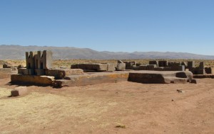
The original power point is at the smaller pyramid base in Puma Punku.
The place has a subtle, light energy that has a clarifying and uplifting effect, particularly in the area of the old core complex from prehistoric times. Today, the element of water can hardly be felt; the energy is earthy-airy.
– Corresponds to: third eye chakra. brain
– Color: indigo/dark Blue
– Dominant elements: Earth and Air
– Corresponding place: Kailash, Tibet
Tiwanaku
In the area near the Peruvian border, 70 km west of La Paz, the ruins of Tiwanaku with its three unique legacies rest on an area of five km2:
– The great pyramid base (Akapana)
– The vast temple complex with incredible megalithic walls (Kalasasaya)
– The huge megalithic complex (Puma Punku)
These prehistoric buildings are only 1 km away from the city ruins and the building elements of red granite and andesite are comparable only to Giza (page 96) and Ollantaytambo (page 232).
Puma Punku – like Kalasasaya and Akapana – is attributed to the pre-Inca cultures starting at around 1,500 BC, but – like the constructions at Ollantaytambo – cannot be explained on the basis of the tools and construction methods that were available.
The Tiwanaku region is thought to be the oldest city complex in the world and was built an incredible 250,000 years ago, according to esoteric sources. I believe 40,000 years to be more realistic – this would place construction in the age of the Lemurians. Scientists have found fossils of fishes, showing that Tiwanaku used to be directly on Lake Titicaca, whose water level has since decreased by 34 meter. Based on the orientation of Puma Punku, archaeologists assume that Tiwanaku was a port city with a vast harbor which could receive several hundred ships at one time. Today, the small village of Tiwanaku, with the old megalithic substructure and city core over which it was built is near the ruins. However, only 2% of the original Tiwanaku city area has been excavated to date. The ruins have been a UNESCO World Heritage site since 2000 and are sure to be the source of many more surprises in the future.
9.3 Main structures
Puma Punku (Puma Gate)
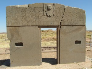
The megalithic constructions of Puma Punku were the original core complex and, later, the intersection with the four gates to the lake, the city, the Akapana Pyramid and the Kalasasaya Temple. They were directly connected by streets as well as subterranean passageways.
We can only imagine how enormous and beautiful the complex, constructed largely of red granite, must have been.
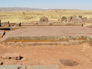
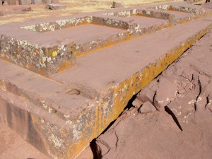
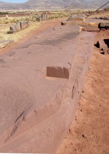
The modern-day ruins are located on a man-made, pyramid-like hill on which huge blocks of andesite, diorite and trachyte lie. One theory posits that the gate was destroyed by subsequent cultures, something I seriously doubt, as we can see in Peru how the Incas preserved and further developed the old, sacred complexes. The idea of a natural catastrophe is much more likely, as even granite tiling and andesite blocks several meters thick were broken, something even a magnitude 10 earthquake is unable to do. Three paving tiles that were four meters wide, eight meters long, two meters thick and weighed about ten tons were shifted from their original foundation. They indicate a size and weight that can only be compared to Giza. What is most impressive is the ground monoliths, from which steps, niches and foundations for further structures were carved, seemingly without effort, resulting in perfect edges and surfaces. Many of the floor slabs weigh between 80 and 130 tons. Below them lies a more than 20-meter monolithic tile that is thought to weigh more than 1,000 tons.
The smaller monoliths and structural elements have also been cut and sanded with incredible precision into a wide variety of complicated, multi-angular shapes. A further sensation is the diorite blocks with two opposing bolt-like recesses that reveal small, square rectangles, similar to zipper elements that lock into counterparts. After the shapes had been entered into a computer, it calculated how the stone elements fit together. All recesses, bolt indentations, grooves and edges could be assembled to create a seamless wall. This means that the diorite blocks must have been systematically prefabricated and then assembled much like a modular construction system. Further huge, basin-shaped stone walls with fish ornaments lie in front of Puma Punku, which is why this is thought to be the location of the Tiwanaku harbor. However, today it is more than 20 km from Lake Titicaca, meaning that the lake must have been much larger and its water level significantly higher.
Quarries
The official quarry is also about 17 km from Tiwanaku, much like that near Ollantaytambo. From here, the many 2- to 130-ton volcanic granite blocks are thought to have been transported – all without modern tools or wheels, which had not yet been invented and would, in any case, not have been able to bear such weights. A second quarry, mainly for diorite and its plutonic counterpart, andesite, is located on Copacabana, a peninsula in Lake Titicaca, about 50 km away; a third quarry is 300 km distant.
Listed below is a selection of prefabricated structural elements, each worked from a single stone block. What is conspicuous is the exceptionally clean stone cuttings, multiple-step reliefs, openings and channels that evidence highly developed building techniques. There are stone blocks that were held together with clamps or assembled with locking bolts, precisely fitted stones processed to resemble twin tubes and diorite blocks, with precise grooves and evenly spaced holes that feature panels and ledges. All of this was constructed with incredible precision.
Note:
Volcanic plutonite (granite) such as andesite and diorite, is harder than iron, and even today can only be processed with steel mills and diamond drills.
Kalasasaya – Place of Standing Stones
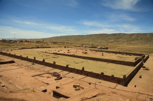
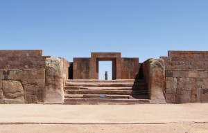
The huge temple is located on a rectangular platform and measures an impressive 130 meter x 135 meter. An eight-meter-wide stairway with six steps leads upwards to the stone entrance of the structure, over whose center the sun rises at the equinox. In itself, this is a reason to think that the Kalasasaya was a pre-Inca sun observatory.
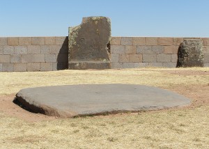
The almost-square Kalasasaya, whose solidly filled outer surfaces, are oriented towards the four cardinal points, its main axis running from east to west. It contained the inner courtyard complex, half of which lies below ground level; on either side of the temple, the ruins of 14 rooms have been found. The reconstruction was relatively simple because many andesite pillars from the original walls survived. They were not as easy to steal as the wall blocks between them, which were significantly smaller than the stone blocks in the outer walls, of which only the uppermost row could be taken away for the construction of other buildings in the modern era. Notches were found on these stone pillars that show how the wall stones were connected to each other.
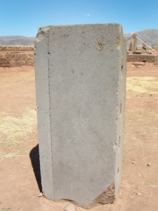
These construction methods are also evident on the outer walls, to which the Aymara word “Kalasasaya” (“Standing Stones”) refers. The entire temple is delineated by rows of what originally were probably 120 vertically erected five- to seven-meter high granite, diorite and andesite monoliths, much older than the stonework between, which is of similar dimensions (see Fig. 9.29 ff.).
The temple complex is thought to be a sun observatory, not least because the year’s natural divisions could be depicted on a 30 meter row of pillars on its west side.
Akapana Pyramid
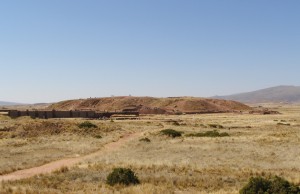
Today, only a rectangular, 15 meter high mound approximately 180 meter long and 140 meter wide, also called the “sacred hill of Tiwanaku”, is left.
Originally, however, it was a pyramid with seven steps, a side length of 200-210 meter, and a height of 17-20 meter.
The pyramid is precisely oriented to the four cardinal points and had a special twelve-sided shape.
The seven levels of the outer walls consisted of perfectly fitted, smoothed andesite blocks decorated and lined with metal, reliefs and paintings. (After the Spanish Conquest, most of the blocks were brought to La Paz to build the new colonial buildings, which is why only about 10% of them are left.)
The inner chambers and passages were also built of stone blocks but the big gaps were filled in with a mixture of soil and stones.
In the center of the uppermost surface, a deepened inner courtyard in the shape of a perfectly square cross was precisely oriented to the four cardinal points.
But the biggest riddle are the tunnels and passages, which I want to point out again because they are generally simply referred to as cloaca maxima. The small, narrow channels definitely served as a wastewater disposal system but the larger tunnels through which one can crawl, much like those leading through the pyramids in Giza, definitely had a different purpose.
Because they were reburied, as has been mentioned, the central tunnel was examined with a remote-controlled robot during the PAPA project in June 2006 (much like the 2002 project in the Great Pyramid at Giza, see Volume I: Giza Legacy, page 199).
The channel starts about three meters below the Acapana tip, and 18 meters of its length towards the north have been explored so far. It is assumed that there are further tunnels in all four cardinal directions and that more chambers can be found in and under the pyramid.
The theories regarding the purpose are more varied here, ranging from it being the central building of the Tiwanaku culture to a sacrificial altar, a temple or a fortification.
9. TIWANAKU / Tiahuanaco (Bolivia)
9.1 Landscape 399
– Geography 399
– Geology 400
– Climate 401
– Vegetation 402
9.2 Power place 404
– Names 404
– Geomancy 404
– Power point 404
9.3 Structures 406
– Main structures 406
– Temple structures 410
– Subterranean structures 416
– Other structures in the region 420
9.4 History 426
– Historical history 426
– Finds 428
– Prehistoric History 429
– Builders and peoples 431
– Original purpose 433
– Legends and myths 436
9.5 Spirit 441
– Religions and deities 441
– Spirituality and transmissions 443

